Hamilton Mountain and Bridge Trail, Washington, USA
hiking
My first Washington summit and plenty of snow on a super-clear day in early Spring.
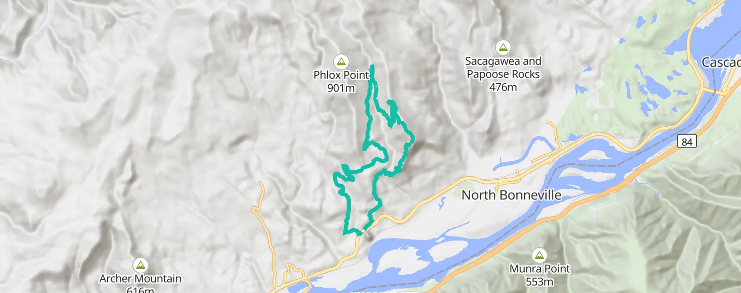
There were wonderful clear skies for a Saturday morning and as anticipated a few people already out and about when I arrived at the Beacon Rock trailhead. I parked lower at Beacon Rock, rather than the upper carpark at the Hamilton Mountain Trailhead, because the original plan included Phlox Point and looked like this:
- Head up the main trail to the Hamilton Mountain summit and then connect to the Hamilton Saddle
- Zig zag the upper trails and take a branch up to Phlox Point
- Drop back to the car via the Equestrian Trailhead and Kueffler Road
I didn’t manage Phlox Point but still caught some great views and solitude along an untracked Bridge Trail. The looping route worked out just fine too.
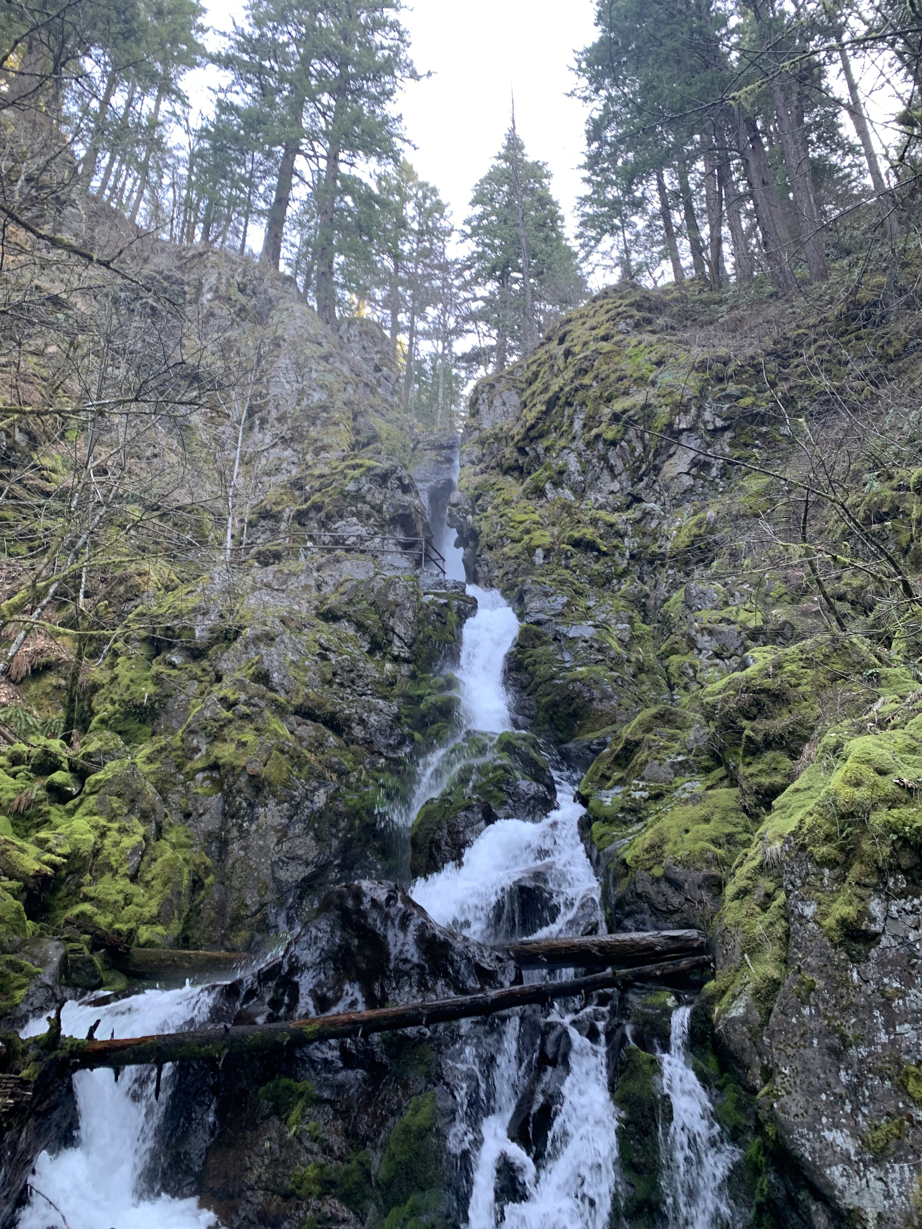
The early part of the day was quite easy going up past the lower bridge over Hardy Creek. This was as far as I’d been on this trail previously, having visited the Rodney Falls and the Hardy Falls lookouts a month or so back.
Conditions were cool but not cold; it definitely felt like Spring.
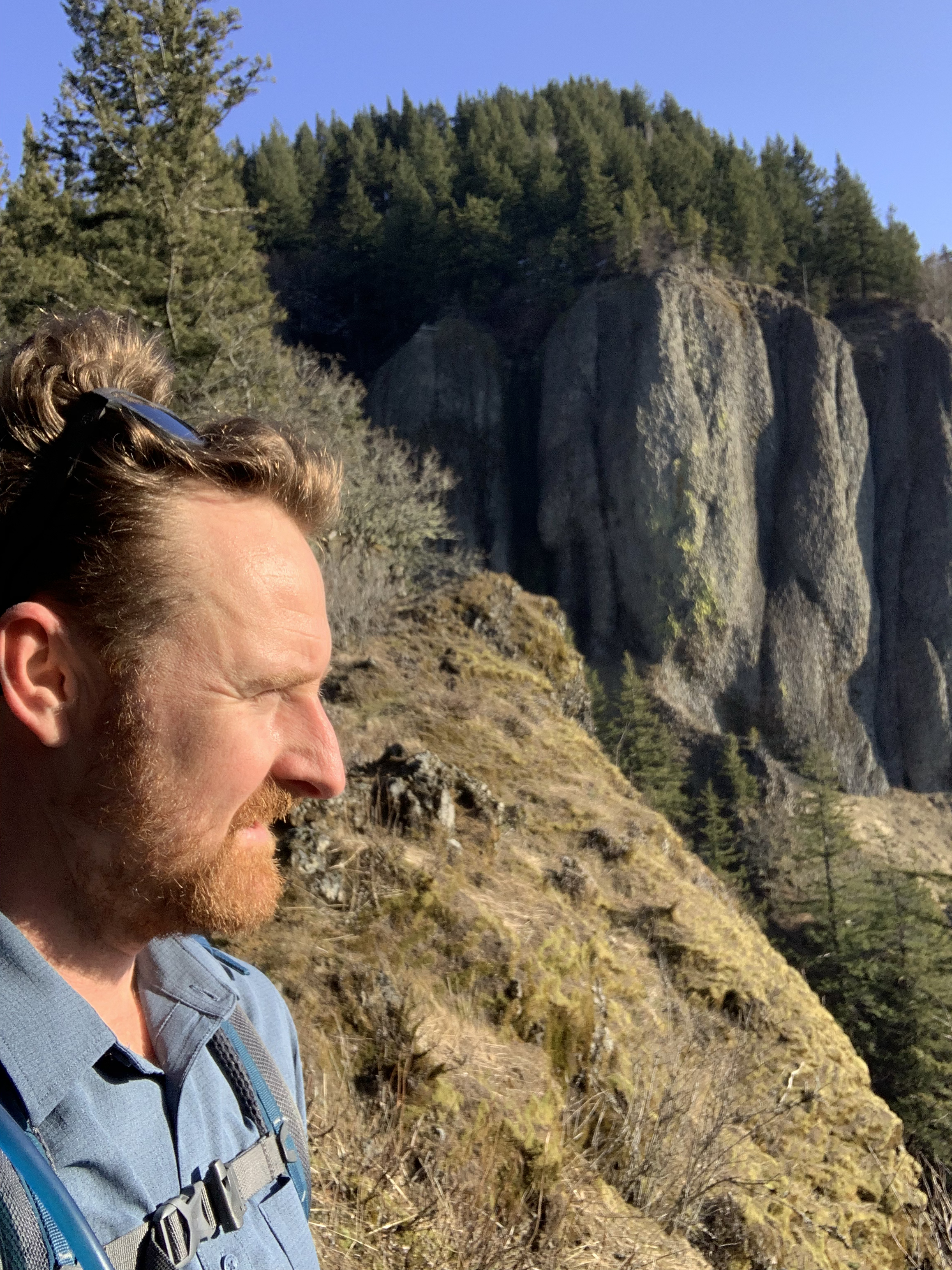
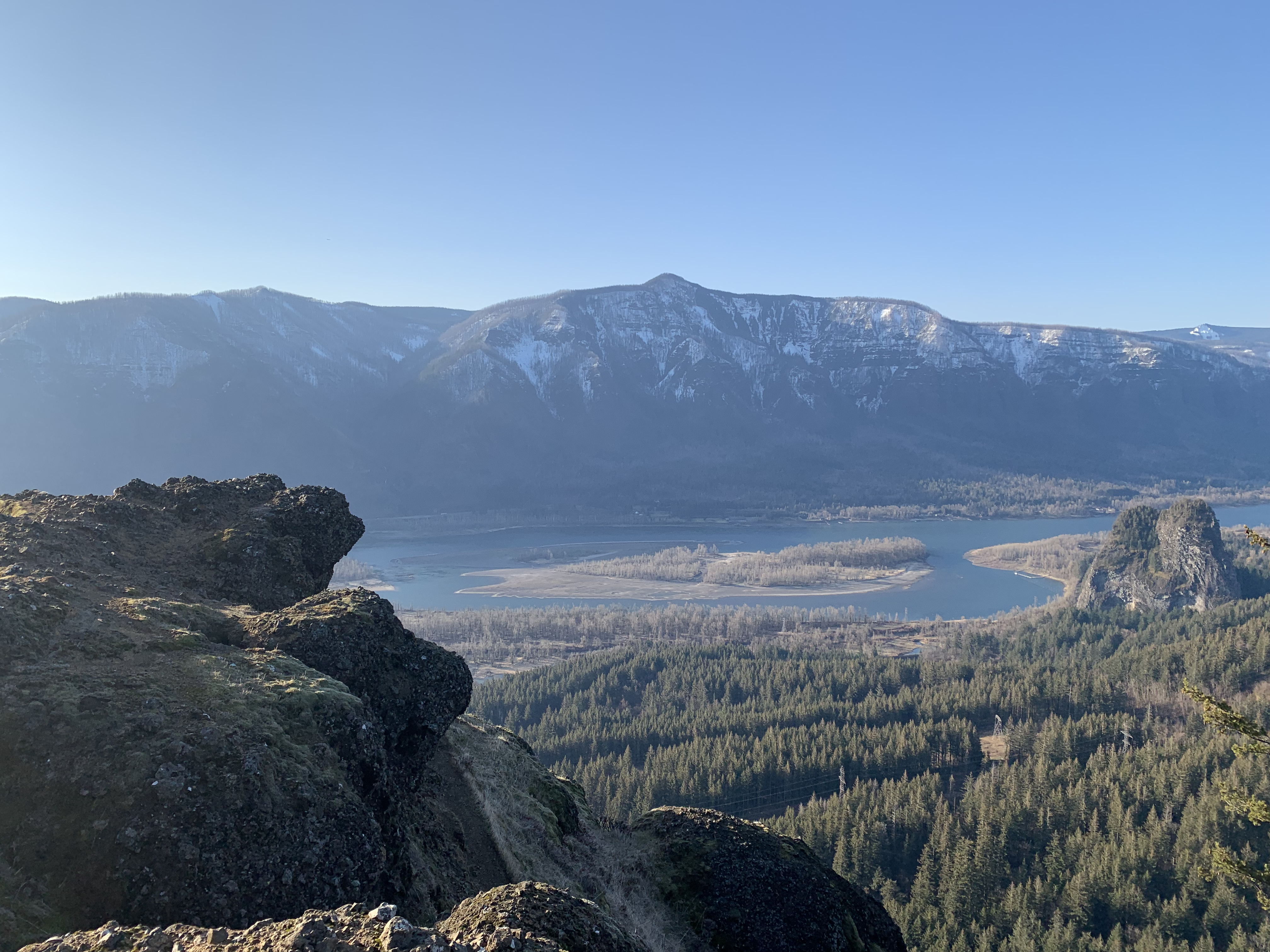
Past the bridge, the grade became steeper with several switchbacks and a couple high ledges requiring a little effort to step up onto. The views out to the Columbia River are great as always.
Heading up the switchbacks I passed a fellow cruising along with a trail coffee (tea?) cup in one hand. Style points. He caught up to me a little later on and we chatted a bit about our travels and interesting trails in the area. Always nice to meet friendly strangers.
Soon after this I encountered the first snowy patch of the trail. The crust was hard and not too slippery so all was well. At the next dry spot I contemplated changing from my running shoes to hiking boots but figured there may not be too much more and decided to keep moving. I promptly regretted that decision after heading around the next corner. It became obvious there’d be plenty of snow to deal with up for the rest of the hike.
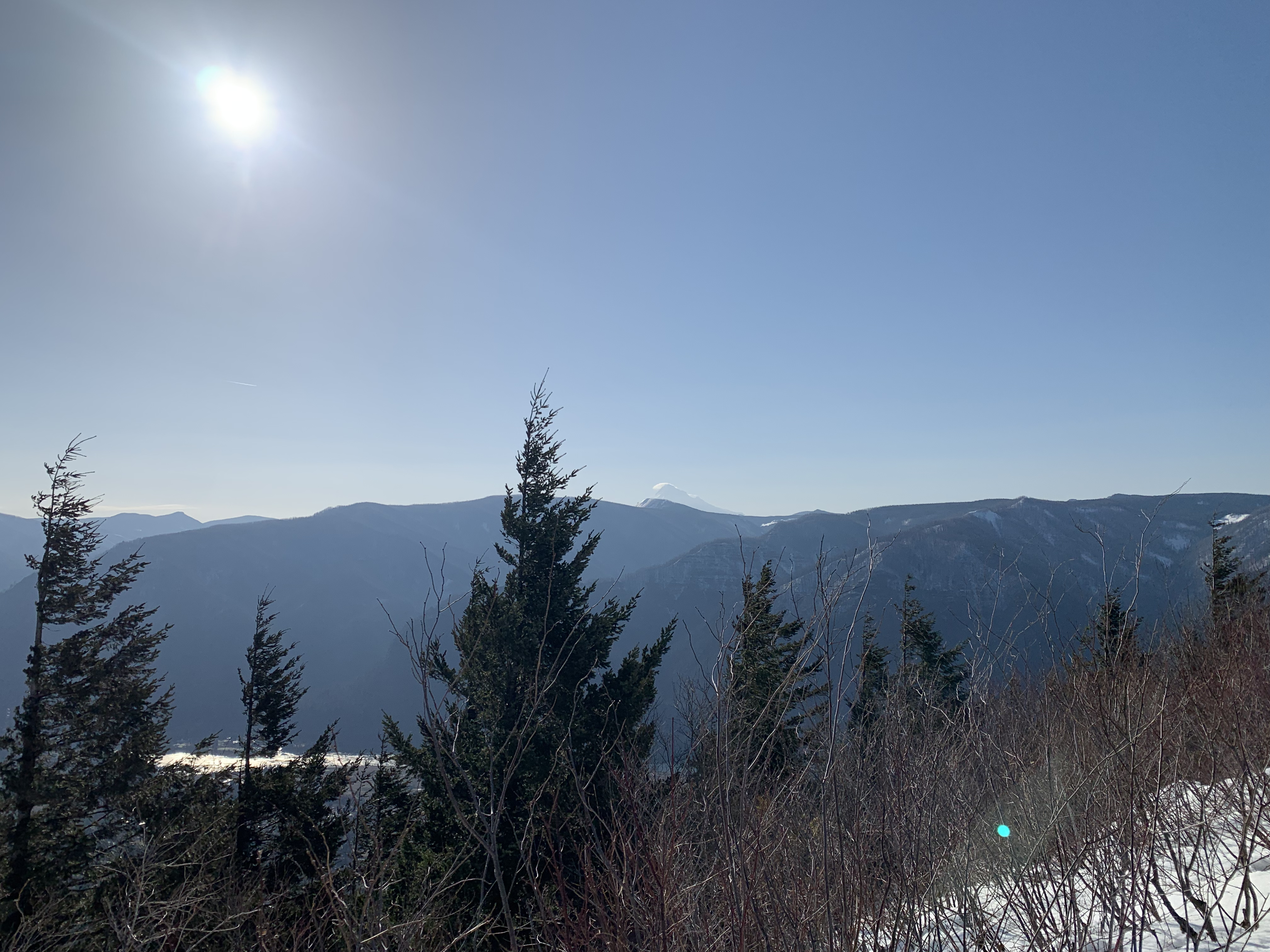
So it was boots on in snow for the final approach to the summit with ankle-to-knee deep snow up on top. There’s no real clearing or prominent lookout spot so I didn’t spend too long on top. At only 743m and with next to no winds it wasn’t at all cold. Being such a clear day, Mt Hood and Mt Adams were visible off in the distance.
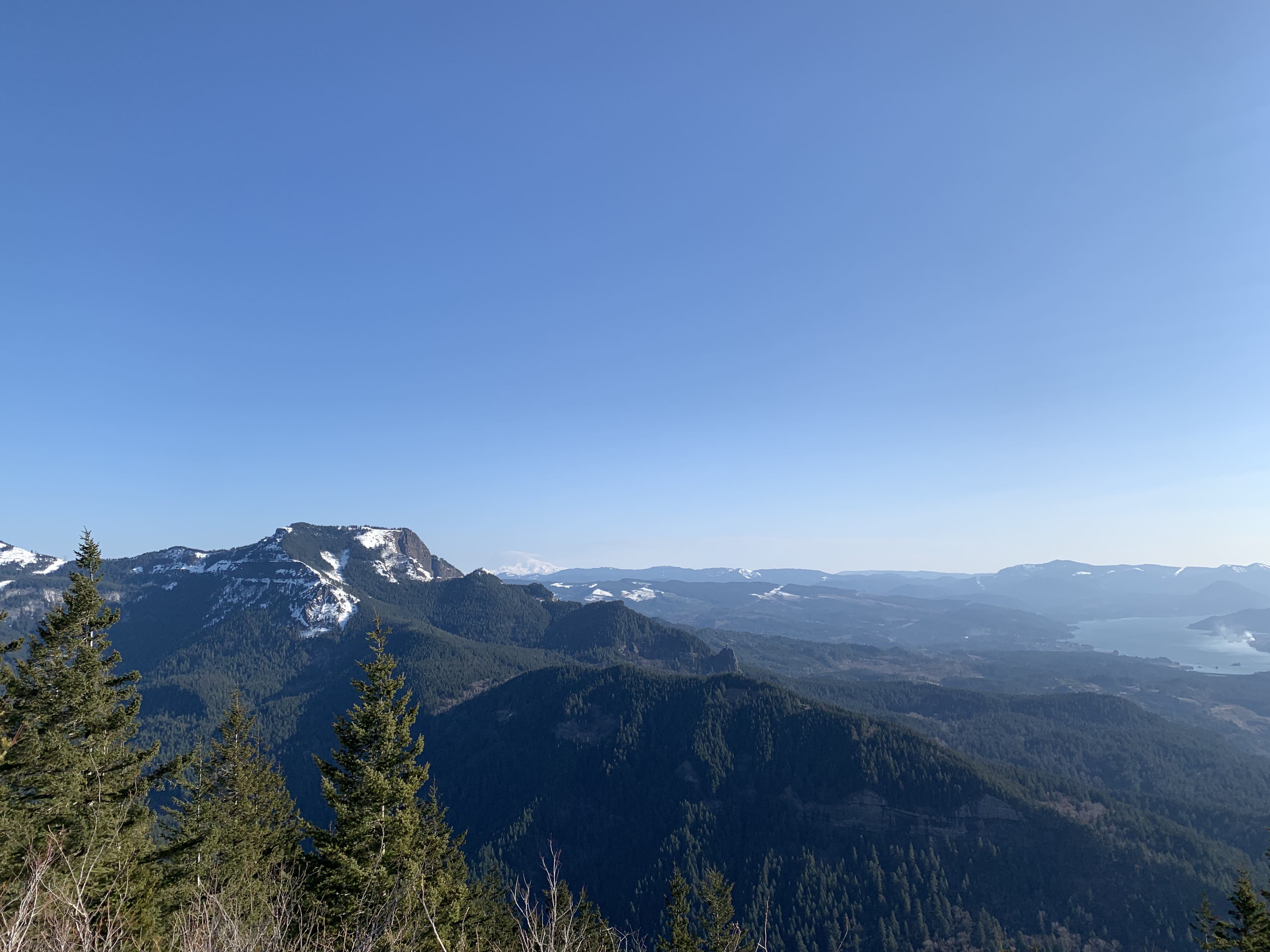
Coming off the summit the hot ticket is to track across to the Hamilton Saddle, which offers great views east and west. This may actually be the better spot to break and take in the views.
It’s from here I see what I’m presuming is Phlox Point towards the northern end of Hardy Ridge. I figure it will be a slog through some snow, but that maybe (and hopefully) someone will have left tracks to follow. If not I’m guessing I’ll have to adjust the plan.
North/North-west from Hamilton Saddle, there are several zig-zagging trails that cross one another. I decide to make a little time by following the Equestrian Trail, then join the Upper Hardy Creek Trail and take Bridge Trail across to the East Hardy Ridge Trail, before finally turning up the Phlox Point trail.
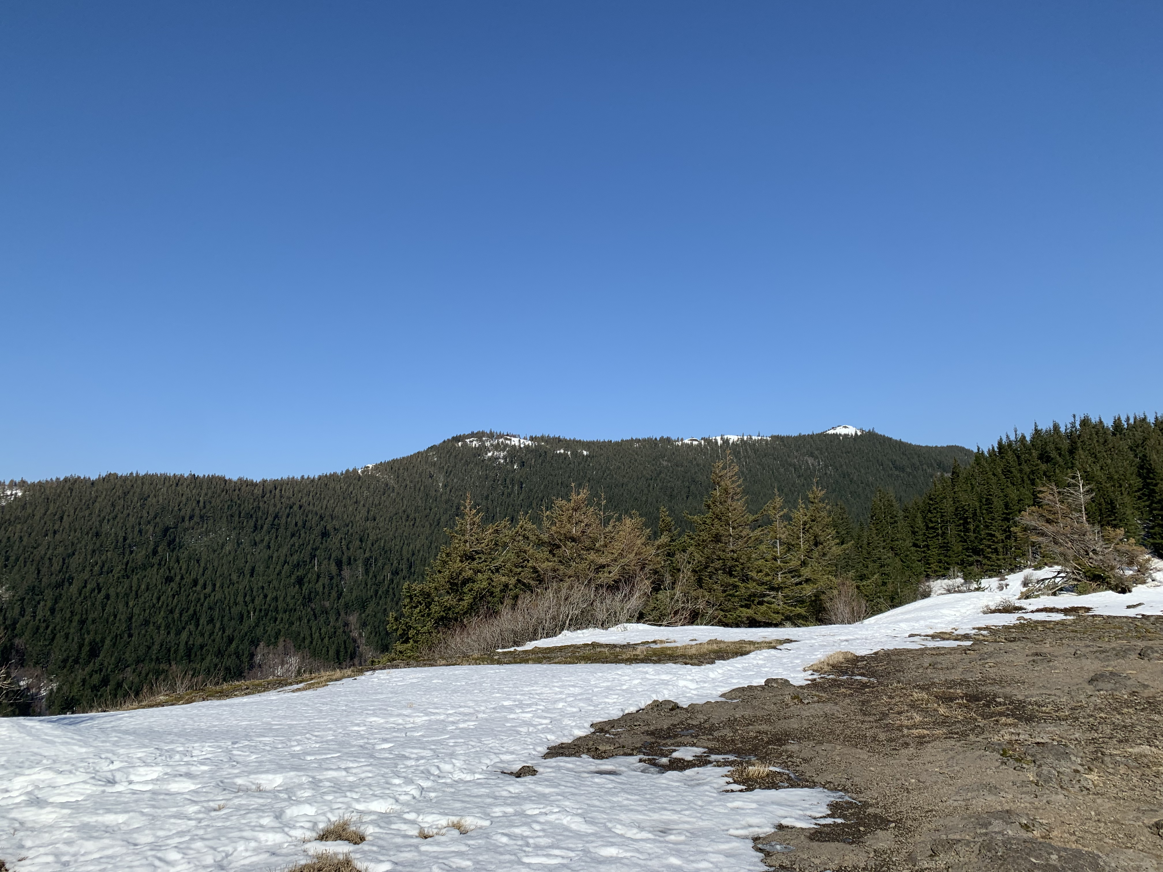
The first section along the Equestrian Trail is a gradual decent with a shallow, well tracked, layer of snow. Nice and easy. Though as I came to the Upper Hardy Creek Trail turn off, I found it untracked and looking like the snow would be getting deeper as this part of the trail ascended higher.
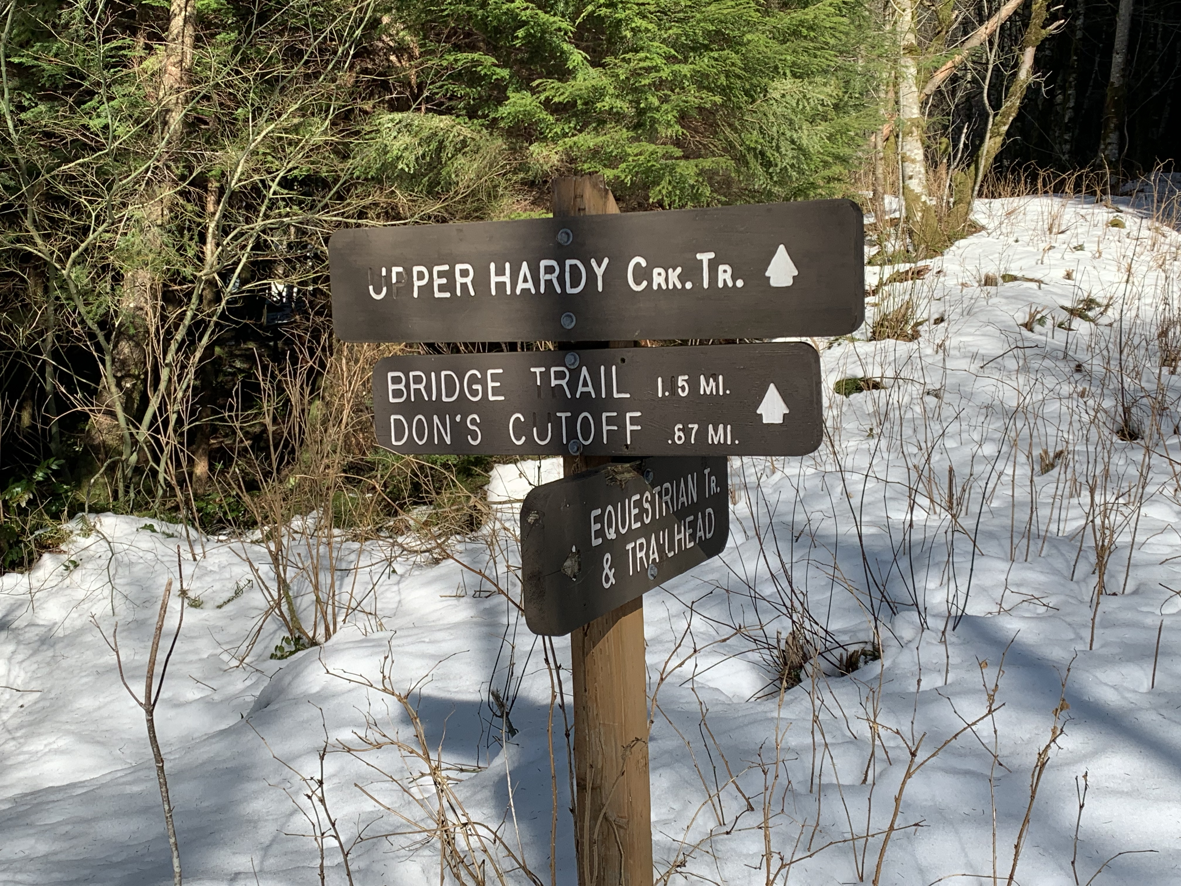
Checking the map there looks to be only 50-75m elevation gain over the next couple km to the turn off to the Bridge Trail. This would be a good bail out point as I’d be able to double back in my tracks if needed.
The snow got to knee depth pretty quickly and I wasn’t setting any speed records while keeping my heart rate manageable. The bridge came into view soon enough but the trail turn off is higher still and at least ~500m away. So I slog onward.
By the time I reached to the point where Bridge Trail turns off from the Upper Hardy Creek Trail, I’m convinced I won’t be heading further and tackling Phlox Point.
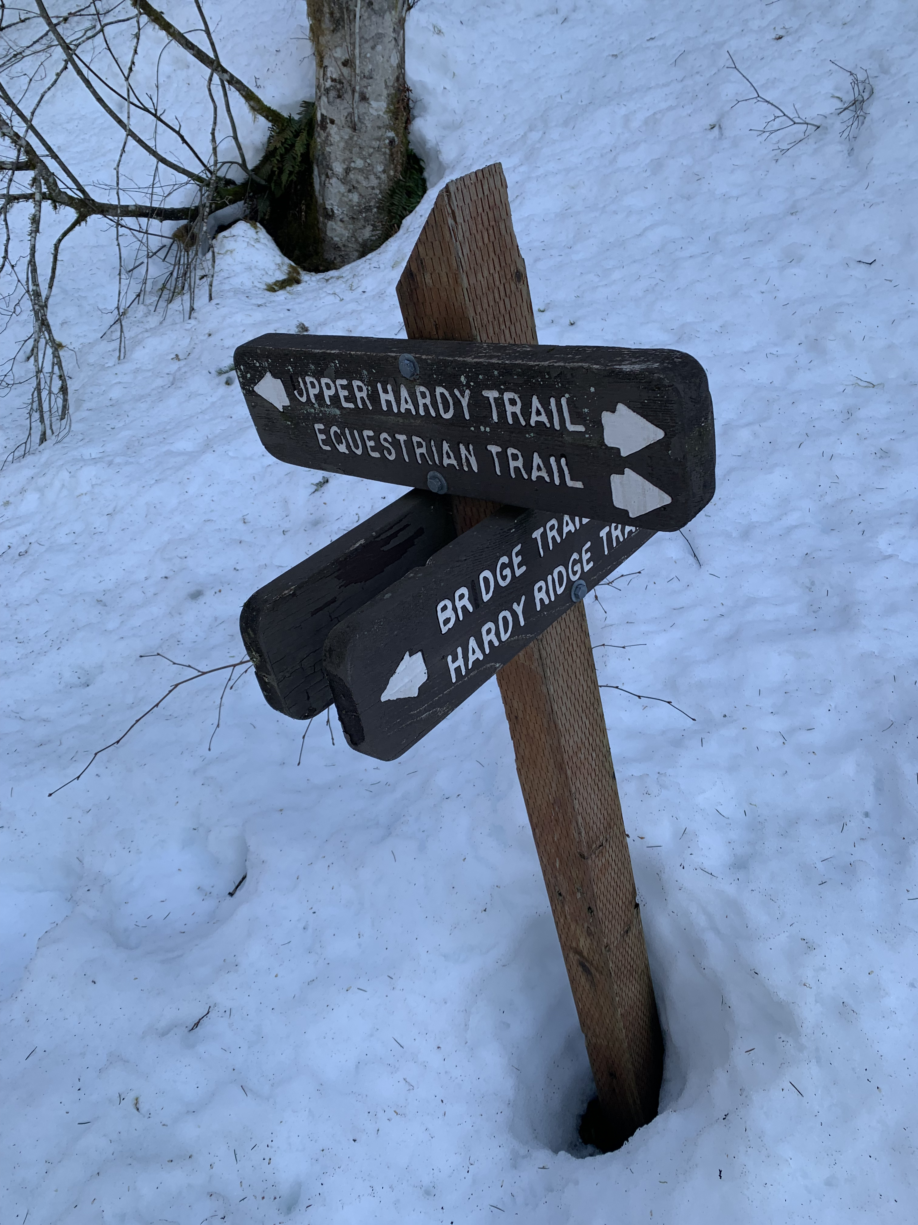
It’s now a question of whether to proceed via the Bridge Trail or head back using my fresh tracks. Distance-wise it’s roughly equal and I was feeling good, so onward it would be.
As expected, the conditions are about the same going forward toward the bridge. I’m thankful it’s relatively new and looking structurally sound, considering the weight of all the snow on the deck.
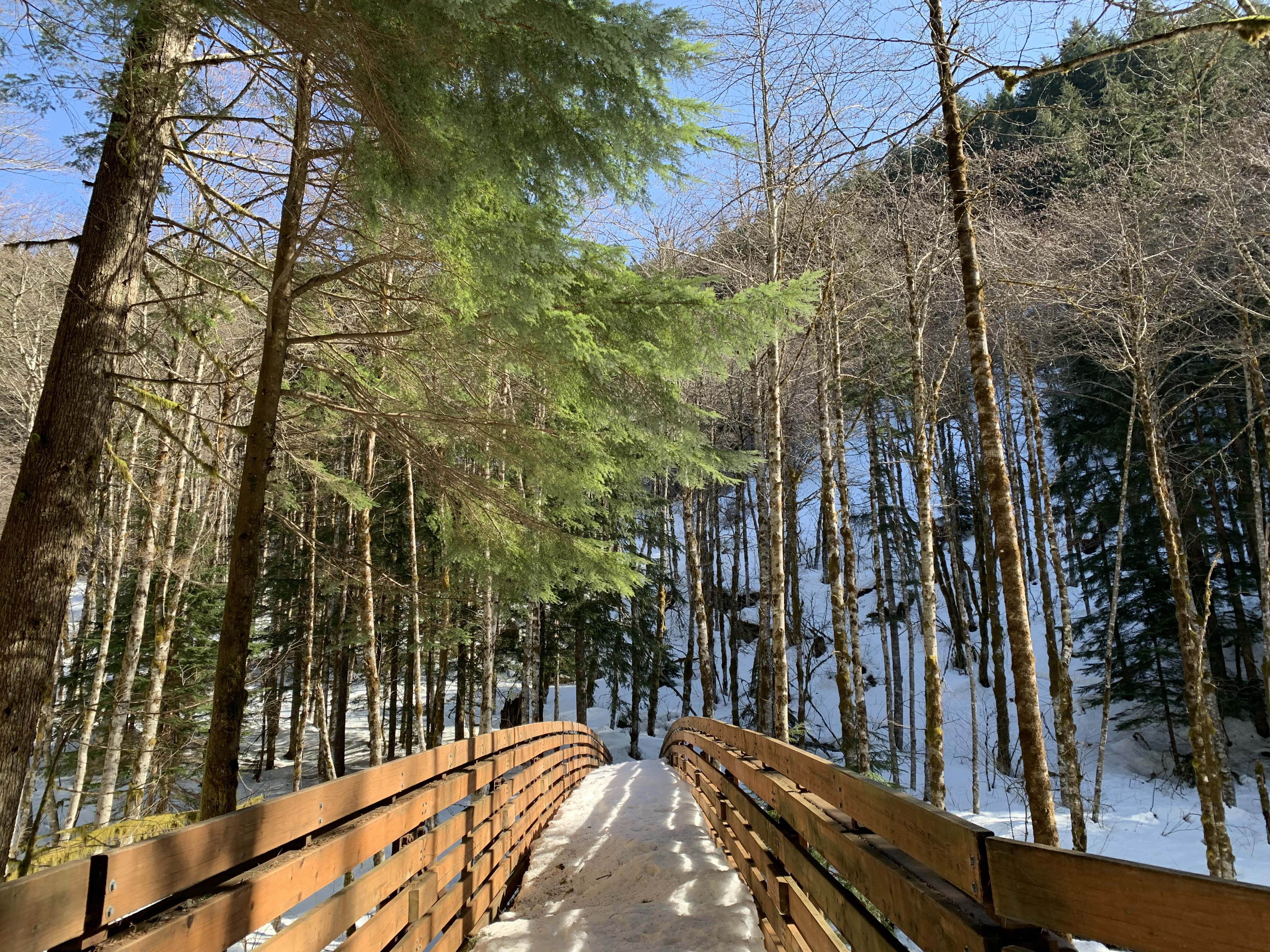
The upper bridge over Hardy Creek may not be all that impressive in summer but it is sure fun to cross in knee deep snow.
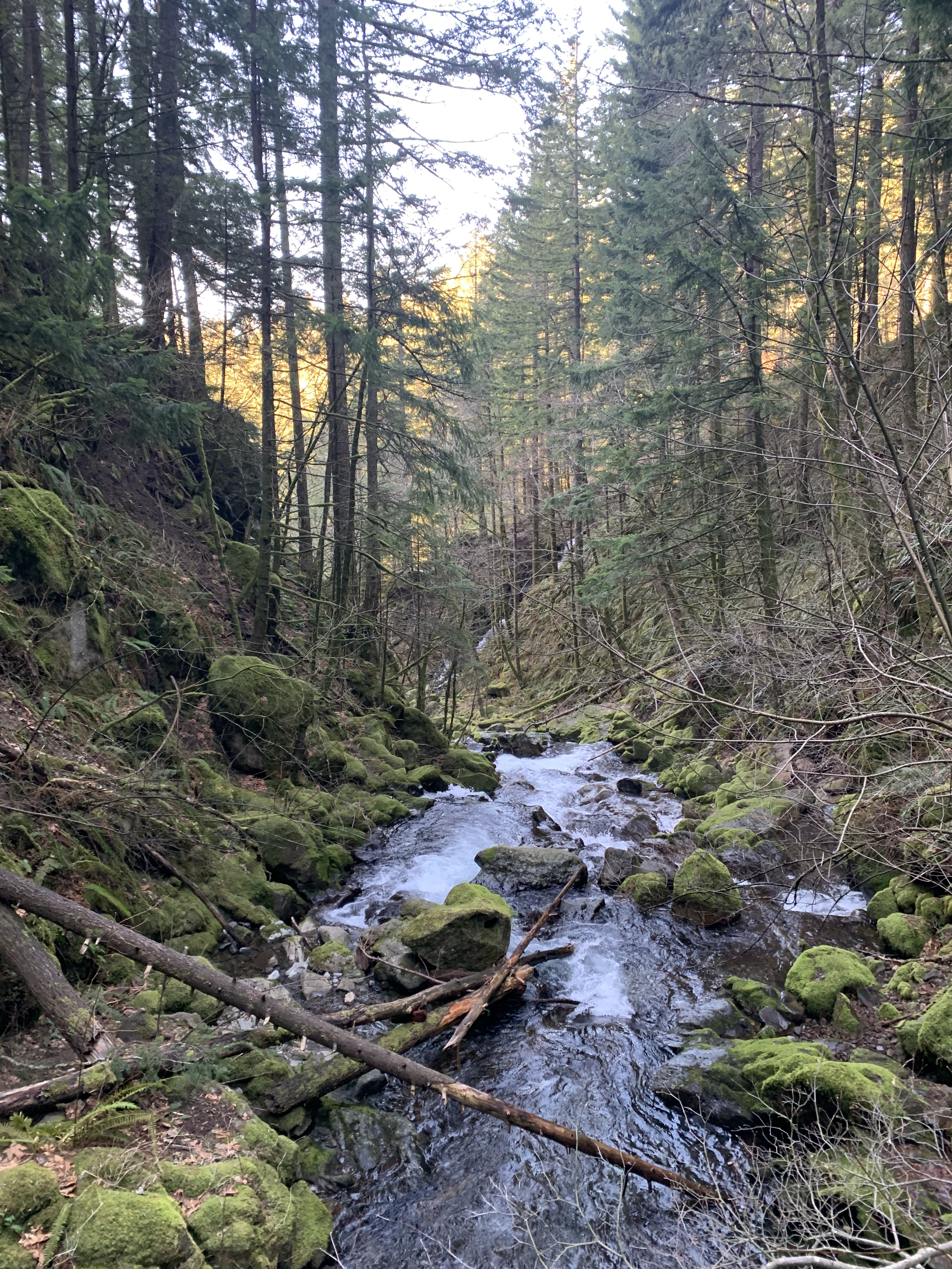
After the bridge the, trail winds along the western bank of Hardy Creek in a gradual descent before joining the East Hardy Ridge Trail. This entire section is untracked, peaceful, and the sun is streaming down through the trees. I couldn’t care less about the the calf burn and the snow-melt that’s now draining into my boots.
After eventually reaching and re-joining the Equestrian Trail joining up with, it’s all easy going and a few groups of hikers appear. I changed back to the running shoes and decided to add the lower part of the Loop Trail to keep things interesting and try to avoid the crowds for a little longer.
By this point all the hard work and the rewards for the effort are the books. The last section was just a long downhill along the Equestrian Trail to it’s trailhead, complete with real live horses. Then down the paved road to Beacon Rock.